|
Careful
attention to scriptural detail is what makes Sister Olive’s setting the best fit
for the Book of Mormon’s
literary locale. It would be great if more Mormons paid attention to their
scriptures instead of surrendering their wits to the pundits and tour guides of
this or that “Book
of Mormon geography” camp!
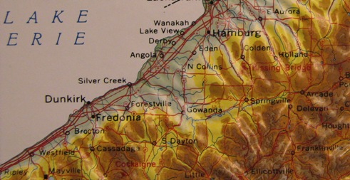
To
anchor the covenant land setting of the
Book of Mormon, we
need to know the location of at least one New World
Book of Mormon land!
Does LDS scripture provide this? Yes indeed! We are given the general
whereabouts of the land Cumorah in a land of “many waters, rivers, and
fountains”, south of one exceedingly large body of water, called in
scripture “Ripliancum”!
(Mormon 6:2-6,
Ether 15:8-11)
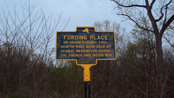
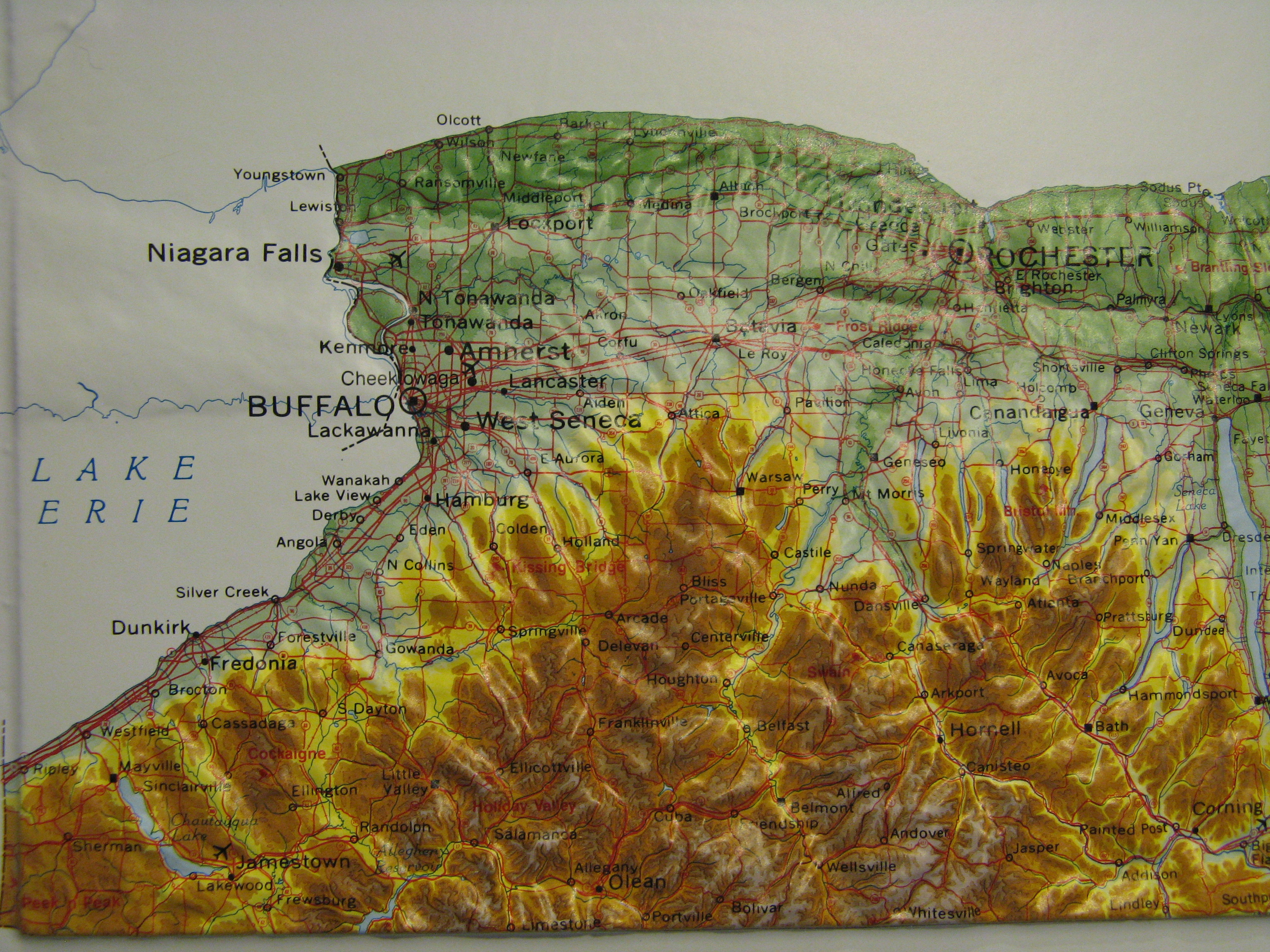
The “word of the Lord” (LDS D&C 127:10) places Cumorah in the
Finger
Lakes region of western NY, south of Great Lake Ontario.
(LDS D&C 128:20) Notice that the verse does not say “hill of Cumorah”, just
“Cumorah”. Mormons forget that Cumorah is a land in a land of “many waters,
rivers, and fountains…” The Smith family farm where
Moroni
declared the fulfillment of ancient prophets-“the book to be revealed” is in
Cumorah – the land!
(Joseph Smith-History 1:36-41
You could not ask for a more fitting , yet unintentional
description of the Book of Mormon “land of many waters, rivers,
and fountains” than that found in a 2012 brochure titled Finger
Lakes of New York Wine Country, an official publication of the Finger
Lakes Wine Country Tourism Marketing Association.
(Finger Lakes Wine Country.com) The article titled “Beyond the Lakes” by Judy McAdoo starts:
“Rolling hills of vineyards, award winning wines,
world-class wineries and, of course, the clear sparkling lakes
characterize the Finger Lakes Wine Country experience. But that is just the
beginning of the story. Mighty rivers and beautiful streams meander
through the woodlands, and majestic
waterfalls cascade over rocky
gorges. Among these “other” waters, relaxation and recreational activities
abound and each season brings its own unique sights and sounds.”
Grapes “grow exceedingly” in true
Book of Mormon country! The
Book of Mormon specifically mentions “wine”, “grapes” and “vineyards” (e.g.
Ether 15:22,
3 Nephi 14:16,
Mosiah 11:15) Wine (the blood of grapes,
Deuteronomy 32:14) was essential to ancient Israelite ordinances. When the
Norse arrived in
North America they claimed to have found grapes
and self-sown wheat. (Hauksbok saga)
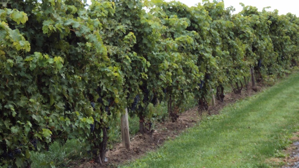
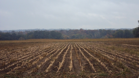
Vineyard up close - near Fayette
We
believe that the
Book of
Mormon “land
of Zarahemla” near the coast of the “west
sea”, simply has to be in the vicinity of Cumorah. The northern land of the Jaredites (including Cumorah and the hill Ramah) was so near to the
land of
Zarahemla
that a search party sent out from the more southern land of
Nephi
mistook a locale in a “land among many waters” for Zarahemla.
(Mosiah 8:7-8;
21:25-26)
The Book of Mormon land of
Zarahemla
cannot possibly be thousands or even hundreds of miles from Cumorah’s land of many waters.
You may have heard about “Zarahemla” in
Iowa,
across the
Mississippi
from Nauvoo. Scripture does not say that the early Mormon Iowa community named “Zarahemla”, was built upon the
Book of Mormon land
of Zarahemla.
(LDS D&C 125:3, March 1841)
There is no statement by Joseph Smith or his associates indicating that they
ever thought, or were told that the Book of Mormon
Zarahemla was in
Iowa. This is why after the Lord
“let the name of Zarahemla be named upon”
the Iowa settlement, John Taylor and Wilford Woodruff
published the highly speculative notion that
“Zarahemla” was at Quirigua!
(See
Cumorah!
Not
Quiriqua)
No the Iowa Saints did not name their
community New Zarahemla, just “Zarahemla”, but this does not prove it to be
the original Zarahemla. The Saints gave Book of Mormon namesakes to
places they settled in Utah. E.g. “Manti”,
“Nephi”, and “Bountiful”.
A simple enough reason for giving a town a Book of Mormon namesake is
to bring up the subject of the Book of Mormon when strangers ask about
the curious name. There could have been additional reasons the Iowa
settlement was named Zarahemla:
Sister Olive cites a noted archaeologist (William A. Ritchie) on the possibility of a native site
in
Iowa being related to a people who anciently
inhabited
New York;
and the Mexican historian Veytia points out that migrating Native Americans had a propensity for
naming new settlements after former ones.
Could there have been an ancient site in Iowa with the
Book of Mormon namesake?
(Choice
Above All Other Lands, Chapter Two)
We
shouldn't be surprised to discover the remains of Mound-builder cities and
temples along the Mississippi.
What if one of the
reasons the Lord requested (or approved) that “the name of Zarahemla be named
upon” one of the gathering places of the saints
(LDS D&C 125:1-4),
is simply because of the
meaning of the ancient name?
See
In Search of the Meaning of "ZARAHEMLA"
;
see also
Zarahemla and a verse from Torah.
Bible scholars recognize “Zion”
as an ancient place name. It’s the name of the monumental fortress city on a
hill in the mountains of Jerusalem.
(1 Kings 8:1
Surely no one thinks that when the Lord placed the name of
“Zion” in Missouri
(LDS D&C 57:1-2), he was identifying the celebrated ancient
site of Hebrew scripture? Surely no one thinks that when Latter-day Saints
named a place in Iowa
“Mount Pisgah
”,
they were designating the Pisgah of ancient scripture?
(Deuteronomy 3:27;
TEACHINGS OF THE PRESIDENTS OF THE CHURCH -
LORENZO SNOW, pp. 107-109)
Of course not! Neither does requesting (or permitting) that “the name of Zarahemla be named upon” a
Mormon settlement in
Iowa
prove it to be the site of Book of Mormon renown.
Scripturally speaking, there are serious problems with placing the
Book of Mormon
’s
Zarahemla in Iowa:
The idea that a search party could start out from the South in search of the Iowa / Mississippi River coast, end up in western
New York, and then think they had found
Iowa is preposterous!
The Zarahemla in
Iowa cannot be the
Zarahemla of the Book of Mormon. The original Zarahemla was near the coast
of a “west sea”. Given the location of Cumorah, that western sea
can only be Lake Erie
Principal Nephite lands situate near the northern
Erie coast. The Finger Lakes are eastern seas relative to the Nephite
lands of Zarahemla and
Bountiful.
Anciently, there were even more lakes to the east of principal
Nephite and Lamanite lands. The eastern seas now called the
Finger Lakes are a short distance southward from the Smith
family farm in the land Cumorah.
We
believe scripture shows Cumorah was eastward from the Jaredite land and seat
of power at
Moron.
(Ether 7:5-6;
9:3;
14:6-7,
11,
26)
Moron
was near the
land
of Desolation. The land of Desolation featured a
small neck of land or narrow pass.
(Ether 7:6,
Alma 52:9,
Mormon 3:5,
Ether 9:31)
There really was a small land-bridge westward from scriptural Cumorah. Geologists know it
today as the Batavia Moraine. Unlike much bigger isthmuses which have water
on the north and south (obtusely popularized by tour guides), the
small and narrow, almost inconspicuous Batavia Moraine really did have a sea
“on the west and on the east” of it - exactly as scripture
describes!
(Alma 50:34) In fact to this day there are
wetlands nearby - remnants of an ancient inland sea called
Tonawanda
that extended from Lake Erie
.
The
true “small neck of land” passing through the watery remnants of ancient Lake Tonawanda,
along route 77 in western NY. Lake Tonawanda is
“the sea”
mentioned in
Alma 50:34.
This inland sea extended eastward for more than 70 kilometers from what is now the Niagara River
.
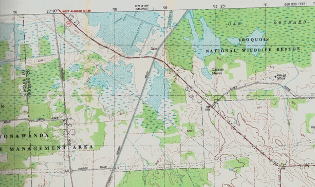
The almost inconspicuous “small neck of land”,
“pass” or “passage” passing diagonally through what was ancient Lake
Tonawanda (arm of Lake Erie) with water “on the west and on the east.”
(Alma 22:32;
50:34) The ancient sea persisted
till several centuries CE, and exists today as wetlands.
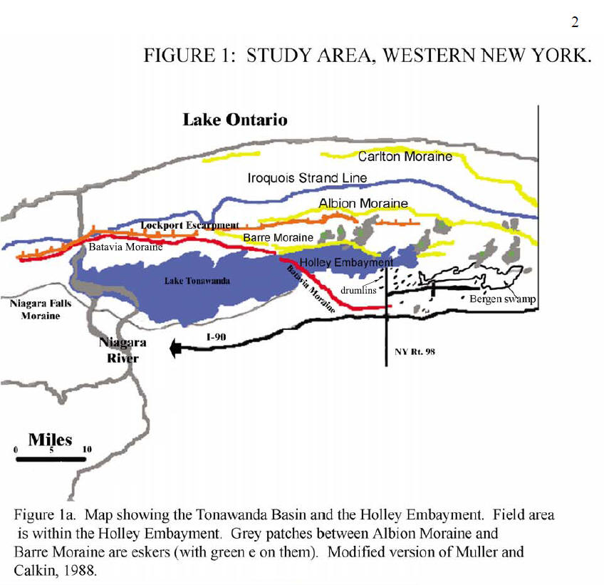
Map from geologist Heidi Natel’s thesis: The
Batavia Moraine (small neck of land) situates on the borders of the
east-west running line of the Onondaga Escarpment. South of the escarpment,
the Book of Mormon land of
Bountiful situates at higher elevation than the land northward – exactly as described
in
Alma 22:30-32
We
believe that the vast heartland of America is genuine Book of Mormon
territory and is sacred land,
(LDS D&C 84:54-59, Enos 1:10)
but we’re convinced much of the American heartland is
the “south countries” spoken of in both the Book of Mormon and the
Doctrine and Covenants – south, that is, of Lake Erie.
(Mormon 6:15,
LDS D&C 75:8)
Book of Mormon peoples eventually migrated to and settled a number
of regions.
Joseph Smith clearly stated, however that the Jaredites “arrived in … the
Lake country of America”
(region of Lake
Ontario) and agreed with non-Mormon historians
Josiah Priest and Alexander von Humboldt on an eventual migration as far
south as Mexico and Central America.
(“American Antiquities”, Times and Seasons,
15 July, 1842, Vol. 3, No. 18, pp. 858-860; signed “ED” by Joseph Smith.
Compare Joseph’s signed editorial with Josiah Priest,
American Antiquities, “Traits of the Mosaic History found
among the Azteca Nations”, pg. 202, 1833 edition.)
We
believe that the covenant
inheritance of Lehi’s seed could have extended as far south as seasons
permitting the observance of Torah, “in all things”.
(2 Nephi 5:10) As for
the placement of principal Nephite, Lamanite lands, we’re convinced that
Sister Olive is most correct, sticking to scripture
as she does:
We
believe therefore that principal lands of the
Book of
Mormon are on the coast of that western inland sea now called
Lake Erie. We are talking about a coastal land that extends only
about a day to a day and a half’s journey inland.
(Helaman 4:7) A coastal
land, comparable in size to the biblical kingdoms of
Israel and
Judah combined.
We are talking about small kingdoms situated between inland yamim (Hebrew
for “seas”) – not Oceans; but accessible from the Ocean. That an inland body
of water can qualify as a “sea” is evident from the
King James Bible.
(Joshua 12:3)
“And now it was only the distance of a day and a half’s
journey for a Nephite, on the line Bountiful
and the land
of Desolation, from the east to the west
sea…”
(Alma 22:32)
Above is the approximate distance between Lake Erie on the west, and an eastern chain
of ancient lakes that existed along northward flowing Tonawanda Creek, south of Batavia.
The line between Batavia and Lake Erie runs more or less parallel to the Onondaga
Escarpment. It can be walked in ~1.5 days! Tonawanda Creek turns
westward and spills over the Onondaga Escarpment at Indian Falls.
See
Why
Lake Erie, and not
Lake Tonawanda,
is the Western Terminus of the Land
Bountiful.
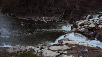
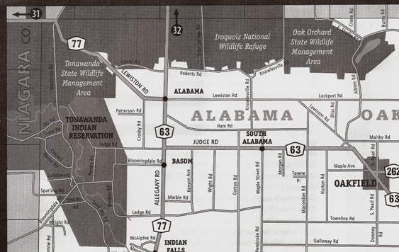
Tonawanda Creek spilling over the
limestone capped Onondaga Escarpment at Indian Falls, not far from "a small neck
of land" (the Batavia Moraine).
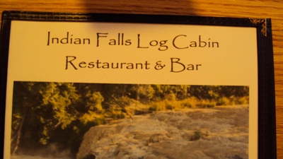
There is a nice little restaurant at Indian Falls where you and a
friend, or loved one can dine, while discussing the significance of where you
are!
Not far from Indian Falls
and “the narrow pass”, which passes through the remnants of ancient Lake Tonawanda,
stands this marker. Here you are not only standing on Book of Mormon
and Church History ground, you are standing on the soil of American History.
Makes sense, right? Nephi saw in vision the American War of Independence upon
“the land of their
inheritance”.
(1 Nephi 13:14-19,
30)
We
believe, as scripture
records, that Lehi’s company didn’t just cross the Ocean to the Promised
Land, they crossed “the large waters into the promised land…”
The First Book of Nephi summary)
The Lord sent missionaries in the early days of the Church to
preach to the “Indian tribes in the West”, identified as
Book of Mormon
“Lamanites”, living near the shores of Lake Erie.
(LDS D&C 32:1-2)
It was from the coast of this west sea that Book of Mormon
peoples “spread” after a period of drought in ancient times; as recorded in
scripture.
(Helaman 11:20) Scripture therefore
indicates that the
“west sea” was a source of freshwater.
LDS scripture clearly places the NY, PA region in the “free”
land upon which faithful Book of Mormon peoples left a blessing.
(LDS D&C
10:48-51)
The principal lands of the
Book of
Mormon (Desolation, Bountiful, Zarahemla, Nephi and, yes, the land of first
inheritance) are definitely not spread over the heartland of America but are so localized near
the coast of the “west sea”, that inland elevation consistently rises as you
journey south. This matches the terrain near
Lake Erie
perfectly.
(Alma 22:27-33;
26:9,
23) It is one of the few regions in America where rivers
flow northward – unlike the heartland.
Southward rise in elevation with northward
flowing rivers, and northern plains
We
believe the river
“Tsidon”
(“Sidon”, King James Bible pronunciation) is a northward flowing nahal
(Hebrew for “brook” or “river”) comparable in size to the northward flowing
Kishon river or brook in the
land of Israel.
This small but famous biblical river actually swept away dead bodies of Israel’s enemies
in the days of Deborah and Barak.
(Judges 5:21) This is the same little
land of Israel whose location is undisputed even
though there is presently little to no archaeological proof of the Bible’s
enormous population claims in ancient times.
(Numbers 1:45-49)
Though famous to Israelites, Kishon is not a mighty river like
the Nile to the South or the Euphrates to
the east, but is a famous local brook or river like the Nephite Sidon. That
Sidon
is a local river like the Kishon, is evidenced by the fact that it is the
only river named in the Book of Mormon’s American setting. Of course
there were other rivers; it’s just that the principal setting of the
Book of
Mormon, like the biblical land
of Israel, is small.
Tsidon literally means “catchery”
but can be interpreted
“fishery” (no explicit reference to fish or fishing). Nahal Tsidon originates in the southern highlands “up”
near Manti
(Alma 16:6-7;
22:27;
43:22,
32) and flows northward on the east
of the land of Zarahemla before turning out to sea (Lake Erie).
(Alma 2:15;
3:3;
6:7;
8:3;
16:6-7;
22:29)
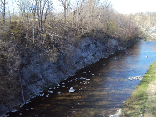
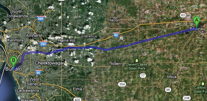
The high banks of the passable, northward flowing Buffalo Creek
(Sidon), east of East Aurora (Zarahemla).
At seasons, the runoff is indeed sufficient to carry away bloated carcasses. (Alma 2:34;
3:3)
In antiquity, the river held
additional water, discharged from a glacial lake in the high valley
south of Johnsonburg NY. (Geologist
Frank Leverett,
Glacial Formations and Drainage Features of the Erie and Ohio Basins,
pg. 210)
No, scripture doesn’t explicitly say that Sidon flows northward. It doesn’t have to!
Scripture implicitly tells us this based on the simple fact that water flows
down hill! The head of Sidon
near Manti was “up” near the “south wilderness”
(southeast of Zarahemla).
(Alma 16:6-7;
22:27) The headwaters of Sidon were even above the
borders of the land Manti.
(Alma 43:22,
32) The
Book of Mormon defines the “head” of a “river of water” as
its source from whence it comes.
(1 Nephi 8:13-14)
When it comes to the head of the river Sidon, some LDS affiliated tour guides
desperately want to redefine a river’s head or make it seem ambiguous
when it’s not.
They mention how the word “head” is used in the context of a
“conflux” or
“confluence” of anatomical fluids
(not rivers), so they can wave their hands and argue that the mouth
(confluence) of the Missouri River is the
head of the Mississippi. They want
folks to believe that the southward rolling Mighty Mississippi is the Book
of Mormon river Sidon. The
same Sidon
which ancient armies crossed on foot in more than one location – no kidding!
Never mind that the confluence of the Blue and White Nile is not called the head
of the Nile.
See
Scriptural River Heads
Lamanites who had invaded the land of Manti from the elevated
south could
“cross the head of Sidon, over to the city of Nephihah” which was by “the east sea”.
(Alma 51:26;
56:13-14,
25)
We know from scripture that this position was elevated relative to the more
northern Zarahemla, for the invaders would have had to “march
down against the city of Zarahemla”
from
there.
(Alma 56:25)
Thus
the original Manti of the Book of
Mormon, near the headwaters of
Sidon, was not only at higher elevation than
Zarahemla, it was near the body of water the Nephites called “the
east sea”.
(Alma 59:5-8;
50:13;
51:22-26)
As for the location of Manti, here too scripture
and verifiable statements by the Prophet Joseph Smith should be given
far
greater weight than apocryphal Mormon
commentary. See
for instance, the Much Ado About
“Manti” in MO.
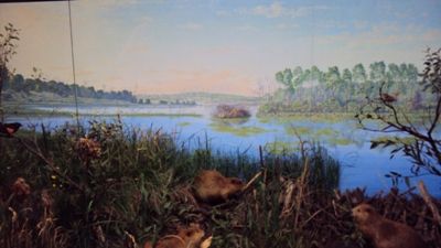
Rochester Museum mural of the region where the Nephite
“east sea”
may have been -
today
reduced to marshland.
Sidon
is never mentioned flowing through the lands of
Bountiful and Desolation to the north, and of course
Sidon is never mentioned in the southern
land
of Nephi because Nephi is at higher elevation than Zarahemla.
(Alma 51:11;
52:12;
53:10)
The headwaters of the river SIdon
was by the eastern end of a “narrow strip of wilderness” that divided the
land Zarahemla from the land
of Nephi.
(Alma 22:27;
27:14;
50:8-11)
The head of Buffalo Creek / River is featured in the relief map, just north
of the eastern end of the Cattaraugus River Corridor (by present day Arcade). At the eastern end of this corridor an
ancient lake
(the Nephite
“east sea”) once resided. (Geologist Frank
Leverett, Glacial Formations and Drainage Features of the Erie and Ohio
Basins, pp. 210-213)
Not to be confused with
“the narrow pass” or
“the narrow neck of land”
, situated on the Desolation / Bountiful borders to the north
(Alma 22:31-32;
50:34;
52:9;
63:5,
Mormon 2:29;
3:5,
Ether 10:19-21),
the “narrow strip of
wilderness” runs east to west, between the lands of Zarahemla and Nephi to
the south. Here we find present day
Zoar Valley Canyon
in the Cattaraugus River Corridor. “Zoar” is a biblical place name meaning
“small”.
(Genesis 14:8)
This name was given the
locale by early colonists. It is particularly appropriate because “Zoar”
(really pronounced “Tsoar”) is similar in spelling and sound to the Hebrew word “zar”
or “tsar” (צר) translated
“narrow”
, “strait” and “enemy” in the Bible.
(e.g.
Numbers 22:26,
Job 36:16;
6:23,
1 Nephi 21:19 or Isaiah 49:19)
In
Isaiah 59:19
the Hebrew word
“tsar” may intend to evoke a “narrow” river, or an
“enemy” invading like a torrent - or both!
The elevated land Nephi is seen in the
distance (looking south) from the Cattaraugus River Corridor – the “narrow
strip of wilderness”.
Cattaraugus Creek flows to the “west sea”
along a wilderness corridor. The eastern end of the corridor is by the head
of the northward flowing Buffalo Creek / River, north of present day Arcade.
(Alma 22:27;
50:11)
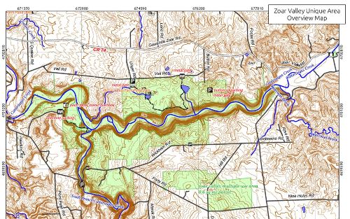
Zoar Valley Canyon in the Cattaraugus River Corridor,
the “narrow
strip of wilderness”.
Sister Olive has picked the surroundings of Canandohta Lake
in Pennsylvania
for a possible site of the “land of pure water” called Helam.
From Helam, it’s about a 12 day journey (old and young with livestock and
belongings on foot) north to Zarahemla (perhaps near East Aurora).
(Mosiah 24:25)
Helam is 8 days south of the
waters of Mormon which was near the site of the city of Lehi-Nephi.
(Mosiah 23:3-4,
19) So the minimum
distance (if you don’t get lost in tall forests) is only about 12 – 8 = 4
days journey directly between the heart of the land
of Nephi and the land of Zarahemla.
Sister Olive’s setting fits the scriptural math!
The land
Bountiful
(northward from Zarahemla) is as scripture records, only about a day’s march
from the north-eastern border of the
land
of Nephi where the city
Mulek was situated. Indeed, the Nephite city by the “east sea” (a lake) was
actually in the
land
of Nephi.
(Alma 53:6;
51:26;
52:19-31) We are talking
about small coastal regions nearly surrounded by water, especially when one
considers the inland seas that really and truly were there in former times,
but which have
since
become marshes.
(Alma 22:32)
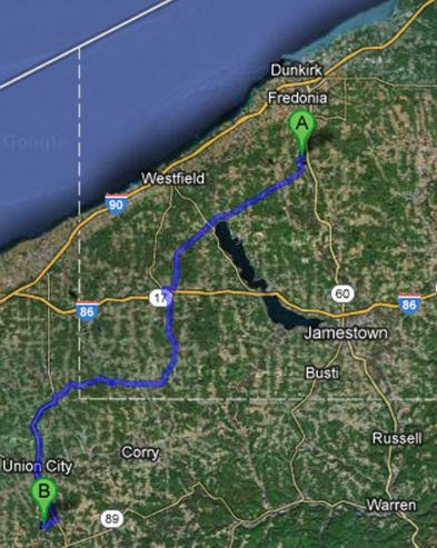
It was about an eight day journey on foot from Cassadaga Lakes
(possible waters and forest of Mormon, environs of Lehi-Nephi,
A) to Canandohta
Lake in Pennsylvania (possible site of the land Helam,
B).
(Mosiah 23:3-4,
19)
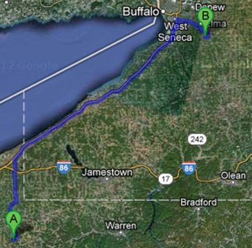
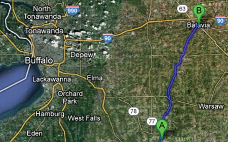
It was about a twelve day journey on foot from Canandohta Lake, PA
(possible “land of pure water”, Helam, A)
to East Aurora, NY (possible site of Zarahemla,
B).
(Mosiah 24:25)

Estimated four or more days
journey between the city of Lehi-Nephi and Zarahemla
It was only a day’s march from the northeaster borders of the
land of Nephi,
near the city of Mulek and the “east sea”, to
the northern Nephite land
of Bountiful.
(Alma 53:6;
51:26;
52:19-31)
The “east sea” was likely a lake (as is the “east
sea” of the Bible,
Joel 2:20,
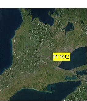
Ezekiel 47:18). It may have been the very lake that situated
in the Java
Lake
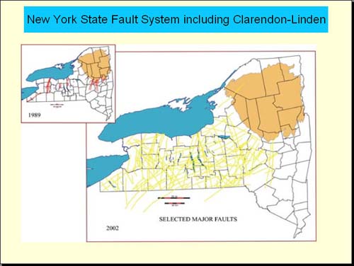
marshland region, near the Clarendon-Linden fault line. (A)
The land Bountiful
is proposed to be near Batavia
NY. (B)
When you pay attention to what is
written, you realize that principal Book of Mormon lands were not spread over
the western Hemisphere, or even over a large portion of
North America.
Yes, western New York has experienced tremors and earthquakes, as
well as tornadoes and town inundating floods. Even in colonial times, Canada just to
the north experienced days of thick darkness possibly the result of massive
fire storms. (“THE DARK DAYS AND EARTHQUAKES IN
CANADA”,
The Historical Magazine and Notes and
Queries Concerning the Antiquities, History and Biography of America,
editor John G. Shea, New York, Vol. VIII, 1864, pp. 60-65)
You may notice, as you study the Book of Mormon, that the
“west sea” is not mentioned north of the Desolation / Bountiful borders.
(Alma 63:5) Instead there are references to “the furthermost parts of the land
northward”
(3 Nephi 4:23)
or “northernmost part of the land”
(3 Nephi 7:12)
as if northern lands come up against watery barriers. This, as you can see,
fits both western New York and
Ontario
Canada!
The more distant northern land (Ontario Canada)
is bounded in each of the cardinal directions by inland seas (Helaman 3:8); but its sea on the
west (“sea west”) is never called the “west sea”.
The
“west sea” is
the name of the
sea west of Zarahemla and Bountiful.
Traveling hundreds of kilometers northward
from western NY to
beyond Lake Simcoe,
one truly encounters
“large bodies of water and many rivers.”
(Helaman 3:3-4)
The biblical expression “spread abroad upon all the earth”, can simply mean over a local land or region.
(1 Samuel 30:16,
Helaman 3:8)
In this land northward, there are inland seas in each of the cardinal
directions, exactly as scripture describes.
Compared to the hilly southern countryside, the northern NY
coast (along
Lake Ontario) is considerably more flat. This matches the plains of the Jaredites
in the land northward.
(Ether 13:28-29;
14:16) See for
yourself as you travel near the coast of Lake
Ontario. Contrast the lay of the land northward with the
southern hill country. Mountains are never mentioned in the Nephite lands
near Zarahemla - only hills. It should be noted though, that what many
tourists esteem to be a hill in the
land
of Israel, may be translated “mount” or “mountain” in the
Bible.
We don’t know for certain where the
city of Moronihah was located. There are mountains in the land northward and
in the land southward relative to the coastal lands of the Nephites.
(3 Nephi 8:10)
All throughout western New York there once were impressive Native
American earth and timber fortifications and
towns
with picket walls (palisades), just like those described in the Book of
Mormon.
(Alma 50:1-4;
53:4)
A veritable trove of mammoth and mastodon remains have also been found
(Ether 9:19), heaps of
human skeletons
(Alma 16:11,
Mormon 2:15,
Ether 11:6)
and even mounds containing metal implements removed by eighteenth and
nineteenth
century armatures called “money diggers”. (E.G.
Squier, Aboriginal Monuments of the State of
New York)
While you’re in the vicinity of
Cumorah, stop at the Rochester Museum of Science and view some of the
artifacts on display.
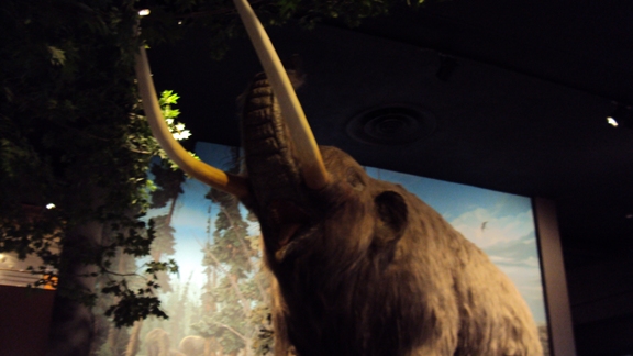
Young NY mastodon - Rochester Museum. The ancient biblical word for “elephants”
may be “habim”
(1 Kings 10:22; “ivory”= tusk of habim =
שֶנְהַבִּים), but what in the ancient world were
“curelom” and “cumom”? (Ether 9:19)
You don’t have to pay a tour guide
to conduct you through sacred Book of Mormon and Church history sites. You can plan your own pilgrimage as my wife and
I have done!
We rented a car,
brought along our GPS, and of course our scriptures. If you actually
experience the land and the distances between sites, we think you
will see that Sister Olive’s setting is scripturally spot on! Ask yourself,
as you travel between sites, could it be so many days on foot (as scripture
indicates) from
here to there? Journeying from site to site, I think it will
become evident to you just how preposterous larger proposed geographies are.
Should
we be
at all surprised that the authentic land of the
Book of Mormon is right
where the work came forth – speaking to us, as it were, from the selfsame
ground?
(Mormon 8:23-26)
All you have to do is accept the
location of Cumorah, given in
LDS D&C 128:20,
and not flinch. Following scripture, details about the
Promised Land fit into place!
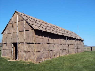
NY Native Long House Reconstruction
(Alma 19:17-18)
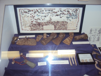
NY Artifacts and the
Book of Mormon's Literary
Locale:
Ephraim George Squier was a member of the AMERICAN ETHNOLOGY SOCIETY, the NEW YORK
HISTORICAL SOCIETY, and the HISTORICAL AND ANTIQUARIAN SOCIETY OF TENNESEE.
His classic work, Aboriginal Monuments of the State of New York (A.M.S.NY) was
published by the Smithsonian Institution in 1849.
The Book of Mormon mentions
heaps of dead bodies covered over with shallow coverings of earth.
(Alma 16:11,
Mormon 2:15) E.G. Squier states
“The purpose of the mounds of New
York, so far as can be determined, seem uniformly to
have been those of sepulture. They generally occur upon commanding or
remarkable positions. Most of them have been excavated by “money diggers,”
…of which… representatives may be found in almost every village.”
See A.M.S.NY, chapter 4, “MOUNDS, BONE-HEAPS, ETC.”
Native
American artifacts of copper (including “copper
arrow-heads”), brass and iron (iron axes) were recovered from Indian
“bone-pits” which contained “a large number of skeletons”. Squire attributes
the artifacts to both “modern and remote date”. The Book of Mormon
mentions articles of copper, brass and iron. Similar metallic objects feature in
nineteenth century literary works on the
American
Mound-builders.
Of course, mainstream American History and
Literature specialists do not regard the Book of Mormon as a work of
ancient history. The fact that NY amateur excavators, “diggers” (like the
youthful Joseph) were made aware of precisely these kinds of finds, is all that
is needed to evince archaeological support for the literary
locale of the Book of Mormon – set in Joseph Smith’s own country. In
other words, archaeological support for the Book of Mormon’s setting is not the same as proof that the Book of Mormon
comes from an ancient document. A similar
relationship exits between the Bible and mainstream archaeology.
Showing that an archaeological find fits the
Bible's
literary setting is one thing;
arguing that a find proves the Bible to be completely historical, is
quite another.
Squier contends that archeological
discoveries in western New York were construed to evince the nineteenth
century Mound-builder sensation and mythology:
“The Indians … little dreamed
that his work would ultimately come to be regarded as affording indubitable
evidence of Hebrew … colonization in America; and the builders of the rude
defenses of Western New York, as little suspected…” (A.M.S.NY,
chapter 6, Concluding
Observations, pg. 81)
Regarding the earth and timber fortified towns and citadels
which the Book of Mormon describes
(e.g. Alma 48:8), Squier
writes:
“...Their positions, general close
proximity to water, and other circumstances not less conclusive, imply a
defensive origin. The unequivocal traces of long occupation found within
many of them, would further imply that they were fortified towns and
villages, and were permanently occupied. Some of the smaller ones, on the
other hand, seem rather designed for temporary protection,- citadels in
which the builders sought safety for their old men, women, and children, in
case of alarm or attack.”
(A.M.S.NY,
chapter 6, Concluding
Observations,
pg. 81)
Regarding the date of the fortified earthworks and “castles”
of the NY “Indians”, Squier remarks:
“…I have seen trees from one to three
feet in diameter standing upon the embankments and in the trenches; which
would certainly carry back the date of their construction several hundred
years, perhaps beyond the period of the discovery in the fifteenth century.
There is nothing, however, in this circumstance, nor in any other bearing
upon the subject, which would necessarily imply that they were built by
tribes anterior to those found in occupation of the country by the whites.”
(A.M.S.NY,
pg. 82)
Squier is willing to admit that some of the trench and
timber ruins could be quite old, as long as no body tries to claim they are
the works of some non-native lost race, e.g. Israelites. LDS
scripture doesn’t
totally disagree, in as much
as the
Book of Mormon teaches that the surviving Lamanites and the decimated
Nephites were related.
Few remains of the numerous and impressive earth and timber
works that once dotted
the
New York l landscape are visible today. But they truly were there! Many
of them, now lost, were surveyed
and documented by respected authorities like E.G. Squier. The Native
American sites were disappearing under the farmer’s
axe and plow even in Squier’s day.
So there is, or was, considerable archeological support
for
the Book of Mormon’s
literary setting in western NY
- in exactly the region
LDS D&C 128:20
places
Cumorah.
The question remains:
Do Mormon affiliated tour guides and
“Book of Mormon
geography" groupies, who promote more
exotic and spectacular locales, have ulterior motives when they
tell people there’s
no archaeological support for the Book of Mormon’s
setting in western New York? Or are they just
plain nescient?
Why do so many
Mormons look to
“archaeology” to settle the “Book of Mormon geography” controversy?
Surely the Savior’s
words apply
in this case: “...why
is it that the people should murmur and dispute because of this thing? Have
they not read the scriptures...?”
(3 Nephi 27:4-5)
Doesn’t
it make sense that God would place details in sacred scripture
as a service to his covenant people Israel;
whereby they could identify the covenant lands of
their inheritance - if they did not treat what was written
lightly?
If we dismiss inconvenient passages like
LDS D&C 128:20, and vainly set other works ahead of
scripture (e.g.
John Lloyd Stephens’
1841 bestseller), should we be surprised if we end up flummoxed,
wandering for years in a wilderness of embarrassing
contradictions - unable to say for sure whether Cumorah is where scripture
says its is, or in southern Mexico?
(LDS D&C 84:54-59, Enos 1:10)
Good grief! We
claim to know where
Jerusalem’s mount
Moriah is, even though there is very little "archaeological proof" that
Solomon’s temple
actually stood there.
(2 Chronicles 3:1)
We should accept the location of Cumorah given in scripture!
(LDS D&C 128:20)
Vincent Coon
כּוּן וִינְסֶנט
© Copyright 2013
|